Region : Imereti
Municipality : Chiatura
Chiatura located inland Chiatura plateau and the narrow valley of the Qvirila river, at an altitude of 340-500 meters, Gomi-Sachkhere-Zestafoni road. 220 km away from Tbilisi (railway). Chiatura has a humid sea subtropical climate, knows cold winter and relatively dry, hot summer. The average temperature is + 13%, + 2% in January, + 23% in July, -20 absolute minimum, absolute maximum +42. 1100 mm precipitation of year.
Every town has its own history,arising and development of Chiatura was totally based on rich manganese bed. But as archeological researches had proved areas around Chiatura,as main part of upper imereti has been settled since ancient times.Scientists analyzed caves,existed in the canyons of river Kvirila and River Jruchula :”cave of wolf”,” dzudzuana rock” and etc.
There are manu hisrorical and architechtural monuments in the Region of Chiatura,which proots that population of this Georgian area took active part in torming material and spiritual culture of the whole Georgian nation.Among these monuments several are unigue; especially interesting is column of Katcki.One can see huge 40sm,high column and to conguer this column is possible only for alpinists.
In the Fast of Chiatura,on the right side of River Kvirila, through the rocks,is situated an important monument of 13 th centuru,nunneru of Mgvimevi. The village of Katskhi is the site of a tenth century church with six apses,in close vicinity to the unique pillar of Katskhi.
The citadel of Sveri,also hewn in rock,is surrounded by a natural balcony and a stone balustrade.According to Vakhushti Bagrationi,it was built in the ninth century.The Didveli fortress and church,still intact in the village of Bzhinevi,and the fortress of Zedubani,date back to the Middle Ages. St.George’ s Chruch at Dargveti dates from the eleventh century, while the churches in Rganisi and Perevisi were constructed in the eleventh,twelfth and thirteenth centuries respectively.
Some artifacts have been found in the canyon of the Chruchuli River,a short way from Chiatura,that date approximately from the 60-70 millenia BC. Remnants of the world”s oldest iron-melting furnace,bits of iron and slag have been excavated near the village of Navardzeti: they bear testimony to the fact shat Geogians had been using manganese alloys long before our era to produce metal of superior quality.
Manganese deposits in Chiatura were first discovered in 1846 by Akademician H. Abikh.who had a high opinion of their value.
Chiatura region besides manganese ore is rich with quartz sand,which comes out on the aurface by powerful steps and is easily cultivated.
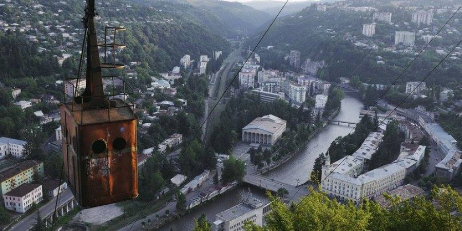
In Chiatura,the first ropeway was built in 1900 and the first cableway in 1948.There were 17 cableways for the passengers and 21 ropeways for manganese,and the whole length of them had been 30 kilometers.
The three part moving cableway in the center of town is really unique.It connects the higt mountainous part with the center of town.
Chiatura – the city with an exceptional terrain
Show at map
Category : sightseeings
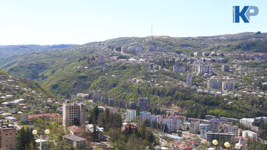
Chiatura is located in the narrow gorge of Chiatura plateau and river Kvirila in Imereti region, at 340-500 meters above the sea level, on the Gomi-Sachkhere-Zestaponi motorway. 220 km away from Tbilisi.
It takes 25 minutes to travel to Chiatura from Kutaisi (73 km).
It is possible to travel to Chiatura with the help of municipal transport. From the station located on Chavchavadze Avenue in Kutaisi, the minibus transports the passengers in the direction of the municipality in every half an hour starting from 7 am to 18 pm.
The population emerged in Chiatura in the Upper Paleolithic period 34,000 years ago.
The city of Chiatura was founded at the end of the 19th century. Its foundation is associated with the discovery of manganese mines.
It is one of the most beautiful cities in Georgia with its terrain and natural monuments.